How FixMyStreet assigns reports to bodies
When you add a body to FixMyStreet, you specify which areas it covers. The areas are typically defined by administrative boundaries: these are not part of FixMyStreet, but are made available through our service called MapIt.
Note that MapIt tells FixMyStreet what administrative boundaries a point lies within: it does not actually draw the maps (by default, FixMyStreet uses OpenStreetMap for that).
How this works
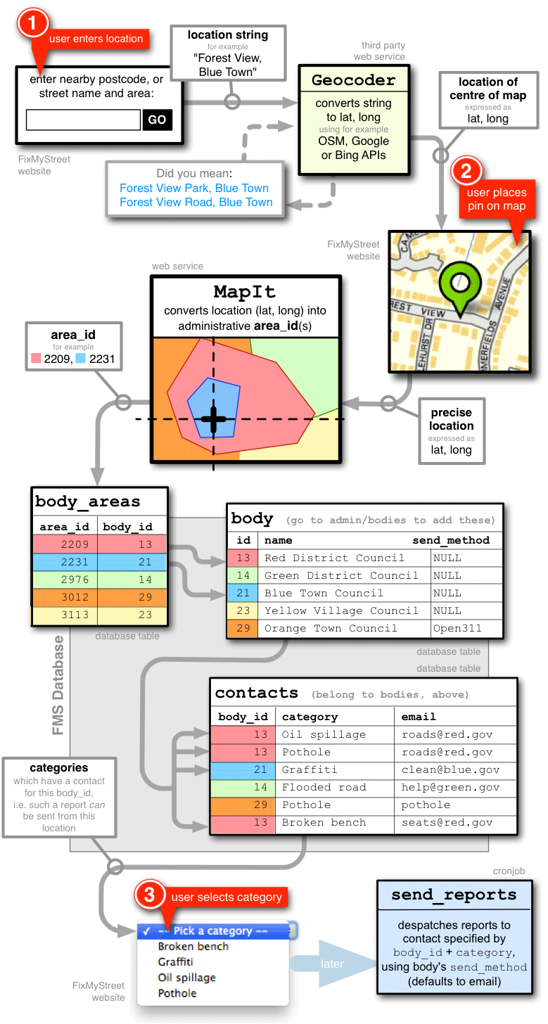
When someone places a pin on the FixMyStreet map to report a problem, FixMyStreet sends the lat-long coordinates of that position to MapIt. MapIt responds with a list of the areas that the pin lies within. FixMyStreet then looks in its own database to find all the bodies that cover that area, and the contacts (which are usually email addresses) that you have added for each of those bodies. Because each contact is associated with a category of problem (for example, “Potholes” or “Graffiti”), FixMyStreet can build a list of all the problem categories that can be reported at this location. In fact, this list appears as the drop-down menu (“Pick a category”) on the report-a-problem page.
This means that your FixMyStreet installation must be able to connect to a MapIt service which knows about the administrative boundaries in your part of the world. See below for more about setting this up.
Detailed flow: location → map pin → drop-down menu
How to set up the area boundaries
The type of boundary data you need depends on a number of factors, but will probably be one of these:
- “Everywhere” – you can run FixMyStreet without a specific boundary
- Simple approximate area – that is, just one area around the place you need
- Simple approximate areas – as above, but for multiple areas
- Accurate OpenStreetMap data – the preferred option
- Accurate data that isn’t on OSM – if you have your own boundary data, for example
If you’re not sure which is for you, read through the whole page about admin boundaries.